Change Detection
Automatically find changes on the ground.
Overview
What is Change Detection?
Change Detection (CD) based on remote sensing technology is used to discover and identify discrepancies in ground objects using two (bi-temporal) or more (multi-temporal) images taken by the same type of sensor, usually Electro-optical (EO) or Synthetic Aperture Radar (SAR), at the same geographical location.
These changes can be predicted from the change in the ground object’s shape, size, and location over a defined period of time.
Change detection is seeing a growing variety of applications ranging from Intelligence, Surveillance, and Reconnaissance (ISR), environmental monitoring, disaster management, urban planning, and agriculture.
- Change Detection proves to be particularly useful in surveillance operations for ground monitoring, maritime awareness, and strategic site monitoring. For example, the rapid expansion of an industrial complex, or the conversion of a civilian airport into a military base can be detected.
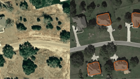
- A visual and easy-to-interpret change detection map can indicate the addition or removal of buildings which is one of the main uses for urban and public space management, cadastral map update, illegal constructions detection, urban expansion monitoring, infrastructure monitoring, and building use classification change.
- Land cover changes are typically reflected in climatology and hydrology, which makes change detection a great solution for resources and environment monitoring. Indeed, human-driven or natural environmental change can be detected on a macro scale to evaluate the results of climate change such as ice melt and coastal alteration. Focus analysis can also be conducted in forest monitoring to document deforestation or reforestation, illegal logging activities, and invasive species or infestation detection.
- Natural disasters can also be detected and monitored in a relatively short period of time as they immediately impact populated areas and alter the appearance of landscapes. With change detection, governments and insurers can better monitor the occurrence of disasters and assess property damages caused by landslides, floodings, forest fires, volcano eruptions, earthquakes, and massive storms.
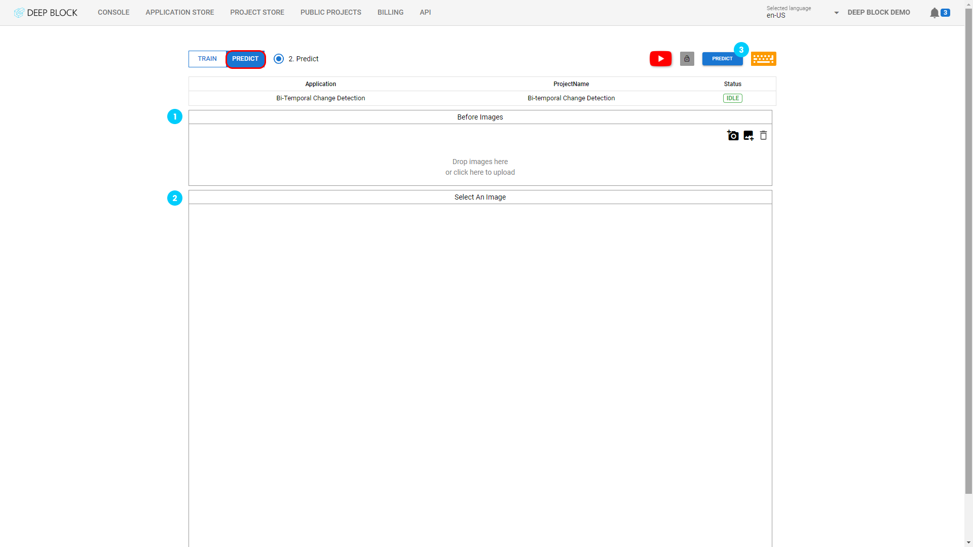
This part is similar to the training phase. Once the data set is ready, you can now upload it to Deep Block.
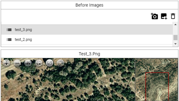
To do so, you will first upload your reference images in the "Before Image" panel.- Click on "
 " to add a reference image via your webcam.
 - Click on "
 " to import your reference images
 - Click on "
 " to remove an image after selecting it.
Image file formats supported are: png, jpg, tiff, bmp, jp2, and geotiff (15GB max file size).
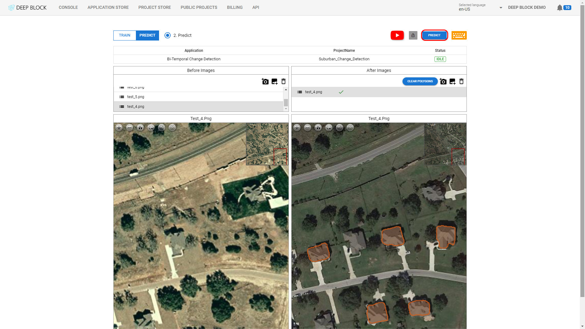
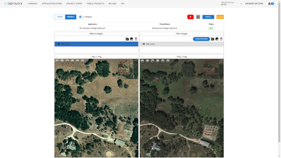
This part is also similar to the training phase. Once all your reference images uploaded, select any image in the "Before Image" panel as a point of reference. You can now upload the corresponding change images in the "After Image" Panel
- Click on " " to add an image via your webcam.
- Click on " " to import images that you wish to label.
- Click on " " to remove an image after selecting it.
Repeat the process individually for each reference image until all your change images are uploaded.
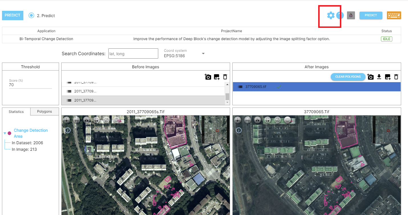
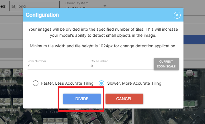
When dealing with high-resolution images, image division is required. Navigate to the Configuration icon and divide the image into manageable sizes, ideally close to 1024x1024 pixels.
Take, for instance, an aerial photograph measuring 5600x4600 pixels; it could be effectively divided into segments of 5x4, 7x6, or 6x5 dimensions.
For explanations related to this, please refer to this link.