menu
close_24px
CASE STUDIES

AI for LARGE Imagery

Here are selected case studies showcasing how we applied AI-driven large-area image analysis to solve real-world challenges across industries.

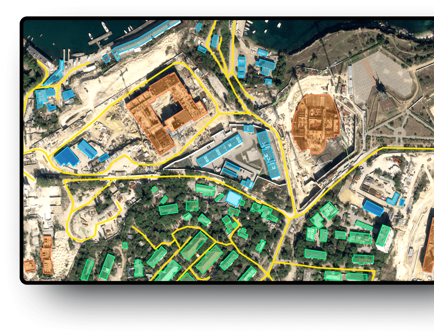
Our innovative solutions have empowered businesses to make smarter, faster decisions by extracting valuable insights from satellite, aerial, and microscopic imagery. Whether it’s improving agricultural yields, monitoring infrastructure, managing natural resources, or enhancing urban planning, our technology transforms massive streams of complex image data into actionable intelligence.

Explore these success stories to see how organizations like yours have unlocked new opportunities, boosted operational efficiency, and reduced costs by integrating AI into their image analysis workflows. Each case study highlights measurable results, practical applications, and the powerful impact of adopting advanced AI solutions for large-scale imagery.


Deep Block_Urban Planning and Smart Cities-min
Projects

What We Did

We deliver innovative, graphics-based AI tools specifically designed for handling massive images in remote sensing and microscopy. While AI is making waves everywhere, processing large-scale real-world image data still requires deep expertise—simply using open-source Python libraries isn’t enough to extract true value or insights. Our no-code AI builder puts advanced capabilities into your hands, allowing users to analyze huge images quickly and effortlessly, regardless of technical background.

By empowering organizations with intuitive, code-free platforms, we make it possible for anyone to harness the power of AI for big image challenges. Our solutions break through the limitations of traditional image analysis, enabling rapid data processing, scalable workflows, and faster decision-making. Experience a step-change in productivity and see how our tools drive efficiency, reduce errors, and help you unlock more potential from your image data—no coding required.

Urban Planning & Management

We collaborate with various public institutions in South Korea, monitoring changes on the ground and land use, contributing to citizen safety and sustainable development.

Detecting illegal land use for Seoul City
Detecting cars in aerial photographs
Automated land cover mapping of Jeju Island, Korea
Segmenting buildings in aerial photographs
Segmenting solar panels in satellite images

Precision Agriculture & Forestry

We are conducting AI-based monitoring of food production and land use patterns in collaboration with the South Korean government, research institutions, and statistical agencies. In addition to crop yield prediction, utilize Deep Block and aerial imaging for pest surveillance and early detection of disease outbreaks!

Predicting rice yield for the Korean government
Segmenting land cover for land use statistics and crop production monitoring
Monitoring wilt disease outbreaks to protect forests in Korea
Calculating carbon capture areas and monitoring trees

Maritime Awareness & Hydrology

We partner with South Korea's water public enterprise, K-water, and have the technology to quickly identify changes and pollution in the expansive ocean, as well as monitor ships.
Calculating oil spill areas for the Korea Coast Guard
Detecting ships in SAR satellite imagery
Detecting ships in optical satellite images
성남시 변화 탐지-1
Detecting changes in Seongnam city for water source protection with K-water
Detecting sea waste in high-resolution drone photos

Construction & Naval Architecture

We have conducted construction site monitoring and object identification tasks using drones in collaboration with the world largest shipbuilding company and South Korea's largest construction companies.

hd 현대
Monitoring ship construction progress with HD Hyundai
Utilizing AI for land cover segmentation and progress tracking in Samsung C&T's infrastructure development project

Defense & Surveillance

Satellites, drones, and aerial imagery are widely used for IMINT, surveillance, and homeland security.

Identifying aircraft in SAR satellite imagery for Hexagon AB
Tank detection
Detection of Transporter Erector Launcher(TEL) in a satellite image
Oil storage detection
CONTACT US

Interested? Let's get in touch!

Whether it is to get a demo of our Deep Block Platform, inquire about our learning courses, join our latest Bootcamp or explore custom solutions with us, we will be happy to help!